 |
||||
|
East Java, with its capital city of Surabaya, is one of the Republic of Indonesia's thirty three provinces, occupying an area of some forty eight thousand square kilometres. Including the island of Madura, it accounts for a little more than a third of Java's total land surface and supports a population of almost thirty three million inhabitants. To the east, across a narrow strait, lies the island of Bali; to the west is the province of Central Java and the Special Region of Yogyakarta.
The land is one
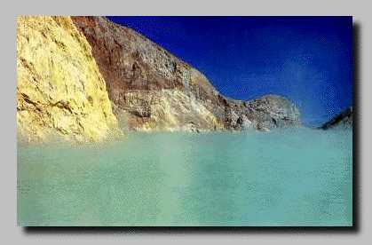
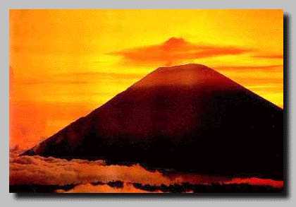
of great variety and natural beauty. Inland, smouldering volcanic
peaks soar upwards to heights of more than three thousand metres,
from where numerous sparkling rivers flow down through rich and
fertile plains to the sea. These mountain ranges actually form
part of a much larger volcanic belt, which sweeps across the
Indonesian archipelago in an arc, passing through the islands
of Sumatra, Java, Bali, Lombok, and eastward to the Moluccas.
East Java itself has more than forty major peaks, at least fourteen
of which are active volcanos. Frequent eruptions, while sometimes
devastating the land as well as causing harm to people and livestock,
provide the long term benefit of ensuring an exceptionally fertile
soil. Everything grows in abundance and rice farmers are able
to bring in two, sometimes three harvests a year. Two main waterways, the Brantas and Solo rivers, are lifelines for much of East Java's predominantly agricultural community. The former rises in the highlands to the north west of Malang, flowing first south and east towards Blitar and Tulungagung, then north through Kediri and Mojokerto to meet the coast near Surabaya. The famous Bengawan Solo, longest river in Java, has its source in the centre of the island, from where it travels 540 kilometres eastward, eventually joining the sea at Gresik. Other important rivers include the Madiun, Konto, Sampeyan and Grindulu. There is marked difference between East Java's northern and southern coasts. The north shore, which faces the calm and hallow Java Sea, has many natural harbours and safe anchorag points and has been a favoured port of call on the international: sea trade route since early times. The south coast, on the other hand, is for the most part exposed and windswept, with few suitable places for shelter. The Sunda shelf, upon which the southern Indonesian islands rest, drops off suddenly to depths more than seven thousand metres just a few kilometres offshore, causing the generation of powerful currents and enormous waves, which roll in from the expanse of the Indian Ocean. According to local belief, these southern beaches are the domain of the goddes Nyai Roro Kidul, who to this day continues to be feared and respected and to whom offerings are still made by the fishing communities before setting off on a journey or starting an enterprise. Despite the fact that East Java lies just 7°- 8° south of the equator, the climate is as varied as the landscape. Coastal plains and lower hill regions are hot and humid, making conditions ideal for wet rice cultivation. Further up in the hills, however, the air becomes quite cool, while in high mountainous areas at night the temperature can drop to near zero. Hill regions are suitable for the production of a wide variety of fruits and vegetables, which thrive in the colder climate. Principal crops, aside from rice, include corn, tobacco,sugar cane, coffee, rubber, kapok cloves, tea, cocoa, peanuts, soybeans and cotton. In addition there are extensive plantations of teak and pine wood. East Java has a distinct wet and dry season, with rain occuring between October and April. The wettest months are December, January and February. |
||||
|
|

