


Tengger Sea Sand Complex
Interpretation Line
Based on result of examining and direct observation on the viled, national park maintainer determines tourism line or irterpretation line in TN-BTS. It is expected that this route will give satisfacion to visitor by enjoying tourism potencies by various ways, or determined ways.
These interpertation line are :
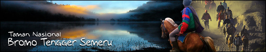
Cemorolawang - Bromo Mountain - Cemorolawang.
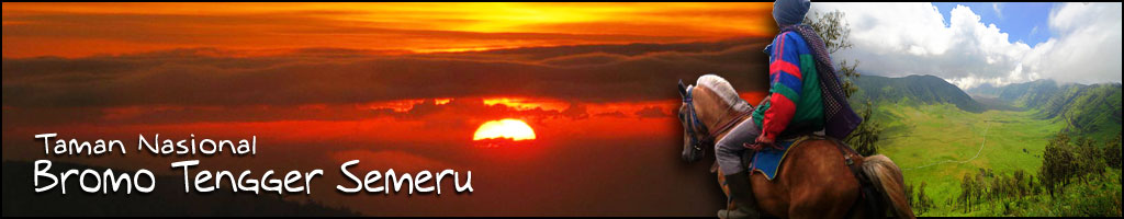
This line is very famous reashed by walking or riding horse(about 3 hours).if this line visited in the morning ,we can see sunrise ,if done in the in the noon ,we can clearly see Bromo mountain activitiy. The most interesting in this line is riding sand see this line generally becomes center of visiting in TN-BTS for bromo mountain and Tengger sea sand.
Cemorolawang - Bromo Mountain - Watangan Mountain - Cemorolawang
This line favored by adult because of its challenge and risky.the journey in it should pass a pathway between two jurang journey throgh this line spends about 4 hours. In this line, we can see beautiful panorama of sand see segoro Wedi lor. It is actualy inactive kawah of watangan mountain this upper sansee is rarely visited ,so that its condition still natural.
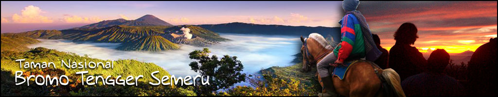
Cemorolawang - Penanjakan - Cemorolawang
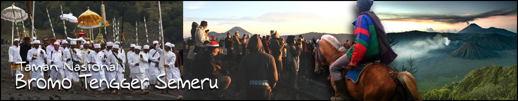
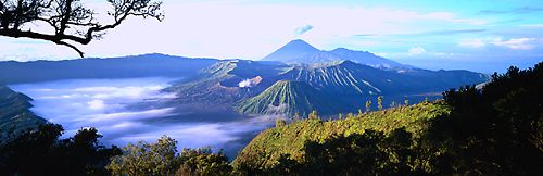
This line includes a path way around san see to penanjakan's peak .by walking, this line needs 5 hours. The most interesting this line is phatway along kaldera Tengger ,so that by walking troug this line ,we can also see a beautiful panorama of sand see. On the peak of pananjakan ,the highest peak Tengger region ,we well be able to see and enjoy a wondrful panorama below it,I,e a span of san sea and a mount of mountain. In the morning, on penanjakan `s peak we can see a spectacular naturephenomeneon,sunrise,sun rising between hill whit a beautiful shining.
Cemorolawang - Bromo Mountain - Watangan - Lava cave - Cemorolawang
Instead detailed in section b, the most interesting of this line is lava cave/well. There we can see the lot of and caves . they are orginally lava from Kursi mountain which experienced cooling proces. By walking , thius line spends about 4-5 hours. Troug this location, we will be able to prove the happening proces of lava cave which is acording to the geological history, it is built from the lava that exist under the ground and because of the cold temperatur, that happen from the hit of our feet, we will able to hear an echo. But when we are doing it, we muts do carefully, because the place where we put our feet is a easily broken and we can fall to it.
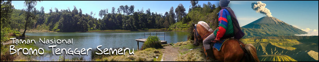
Wonokitri - Bromo Mountain - Wonokitri
This track is much moe further than the trac troug Cemorolawang-Bromo mountain - Cemorolawang. But by taking this trac, we will be able to see a very beautiful view wchich can not be found out from other road or track. To reach this road, we can use motorcars (especially : four wheel drive), by foot or by taking horse. The ideal time whih is need if we take this road is about 3-4 hours. The most intresting things if we take this road is the angle and the very challenging turn of the road that is very risky, but beside this challenging road, we can see a very beautiful scenery the "laut pasir"(sand-sea) in the right side of the track.
Wonokitri - Penanjakan - Wonokitri
This track is very populer because this track can be passing throug by motorcycle or by car and the condition of this road is also good.
Nongkojajar - Kandangan - Bromo Mountain - Nongkojajar
This track is not developed yet and this track is not very popular either but this track has potential to be developed. This is the shortest way and the most save way if we want to go to Bromo Mountain and Nongkojajar (-+ 12 km) but until now the condition of the road from Kandangan to "laut pasir " still in the form of land which is hardened and the length of the rod is very small and it make the car can not passed throug this road smoothly. Along this road (after we passed this road ,we will find the Kandangan village) and in this place we will be able to see a lot edelweiss flowers which is spreading along this road until "laut pasir" the consition of the righ and left of this track is relatively safe and the land is not too high.
View Pasir Berbisik at indonesiavirtual.com