Sebetul Island

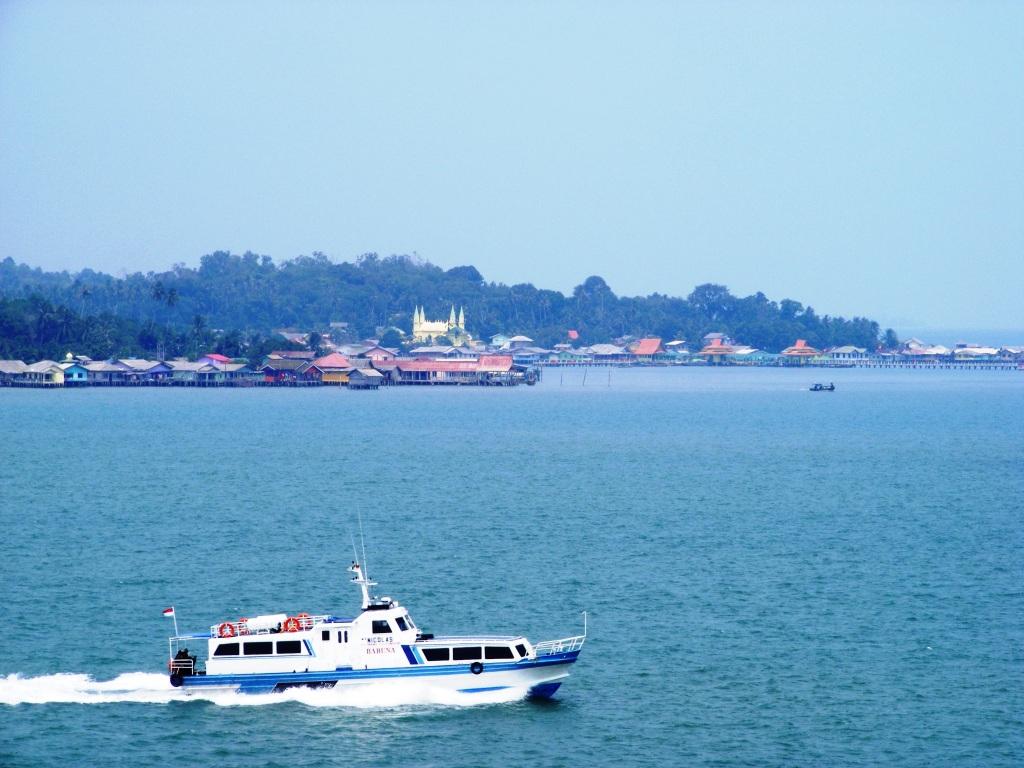
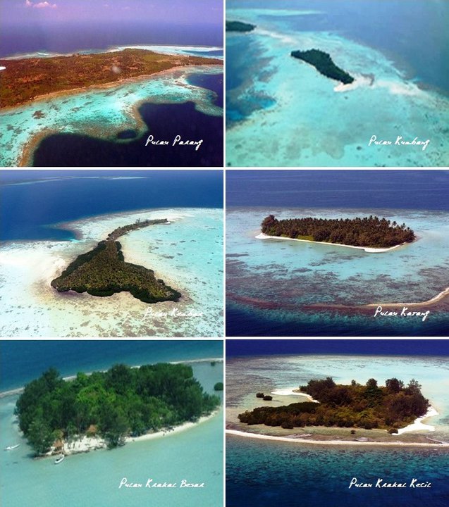
Sebetul Island Sebetul island is the outer islands of Indonesia, which located in the Natuna sea or part of the South China Sea. It borders with the country of Vietnam and it administratively located in the territory of the Natuna regency, Riau Islands province. Sebetul island is kind a rocky island with steep rugged coast and overgrown bushes. It is located in Air Payang village, Pulau Laut District, Natuna regency, Riau Islands Province. Sebetul island can be reached by fishermen boat who frequently fishing on the island. The island is…

Rempang Island – Riau Archipelago

Rempang Island Rempang island, with an area of ??approximately 165 km ², is an island in the municipality of Batam, Riau Islands province which is the second major series of islands that connected by six bridges of Barelang. The island is located approximately 3 km to the southeast of Batam island and it connected by 5th Barelang bridge with Galang Island in the south. At this time, the island Rempang has been developed for agriculture and fisheries for Sembulang region, as well as having some nice beaches. Together with the…

Penyengat Island – Riau Islands

Penyengat Island Penyengat Island is a small island that is approximately 6 km from the town of Tanjung Pinang, Riau Islands province. This island measures approximately 2500 meters x 750 meters, and is approximately 35 km from the island of Batam. This island can be reached by using a boat or better known by pompong boat. By using pompong boat, it takes approximately 15 minutes drive. Penyengat Island is one of tourist attractions in Riau Islands. One of the objects that can be seen are Sultan Riau Great Mosque that…

Merbau Island – Riau

Merbau Island Merbau is an Island and a district in the Meranti Islands regency, Riau, Indonesia. The city district is Renak Rungun. Meranti Islands Regency is a result of the expansion area Merbau District, formed on January 26, 2011. Where the Pulau Merbau District is covering the entire island of Pulau Merbau, while Merbau subdictrict covers the entire island of Padang. The island has bordered with Malaka strait in north, west Tebing Tinggi sub district in south, Merbau sub district in west, west Rangsang in east.     www.indonesia-tourism.com

Tebingtinggi Island – Riau

Tebing Tinggi Island Pulau Tebingtinggi or literally means high cliff island, is an island in Riau province, which is geographically located at latitude (0.9 degrees) 0° 54′ 0″ North of the Equator and longitude (102.75 degrees) 102° 45′ 0″ East of the Prime Meridian on the Map of the world. The locations related to Pulau Tebingtinggi are represented by the nearest distances for a beam of light to travel and may not be nearest by road. For example, Pulau Tebingtinggi, is located 11.7 kilometre from Selatpandjang, 11.7 kilometre from Selat…

Jemur Island – Riau

Jemur Island Jemur Island or Pulau Jemur is an island of Indonesia which is located in the Strait of Malacca, about 45 miles from capital of Rokan Hilir regency, Bagansiapiapi, and about 45 miles from Malaysia. This island is administratively part of Pasir Limau Kapas sub-district, Rokan Hilir regency,Riau province. Jemur islands are uninhabited and only a stopover place for fishermen who are to sea. A post of Indonesian Navy (TNI-AL) was established in this island for the purposes of observation and navigation. Currently, there is no accommodation in this…

Rupat Island – Riau

Rupat Island Rupat is an island in the Strait of Malacca, and administratively part of Bengkalis regency, Riau province. It lies just off the eastern coast of Sumatra, across from Dumai city, across the Strait of Rupat (Selat Rupat). Rupat was one of thousands of abandoned islands, but now the population is growing year after year, then it makes them expand the area for the settlement. This island is can be reached from Pekanbaru, Dumai or Bengkalis. The main transportation line from and to the island is by the sea.…

Bawean Island

Bawean Island Pulau Bawean is an island that located approximately 150 km north of Surabaya, in the Java Sea, off the coast of Java. It is administratively part of Gresik Regency, East Java. It is approximately 15 km in diameter and is circumnavigated by a single narrow road. Bawean is dominated by an extinct volcano at its center that rises to 655 m above sea level. The island is populated for about 75,000 people, but more than 26,000 of them (that is about 70% of the male population) were temporarily…

Parang Island – Karimunjawa

Parang Island Parang islands and surrounding waters (Parang island, Kumbang island – Kumbang Sandbar, Kembar Island/ Twin Island – Kembang Sandbar – Taka Selikur, Katang island – Katang sandbar – Taka Karang Besi, Nyamuk island, Krakal Besar island, Krakal Kecil island – Taka Karang Kapal. This island is part of Karimunjawa archipelago, which consist of 27 islands, and located in the northwest of the island. It can be reach for 1 hour drive by using inter-island boat or 1,5 hours drive by using local fishing boats.        …

Kemujan Island

Kemujan Island Kemujan Island, also known as Kamodian, Kemujan, Poelau Kemoedjan, Pulau Kemudjanis, one of islands that located in Karimunjawa, Jepara. This island is administratively located in the district of Karimunjawa. The island has a marine dock facilities, Dewodaru airport and Diesel. This island has a population of 2936 people with different livelihoods. The island has a rainfall average of 3,000 mm per year with an average temperature of 30-31 º C. The economic potential of the island is in the form of marine fisheries, potential fishing, seaweed farming and…